TGO Challenge 2019 - Trip Report
Posted by Danny Pearson on May 01, 2019

Planning the route was much harder than I had envisaged. There are so many possible places to start and amazing places to walk through. You have to be disciplined and accept that you can’t include all your bucket list routes in one Challenge (a good reason to come back year after year as many people seem to). In the end, I decided on starting in Mallaig and the ferry across to Inverie in Knoydart. There is something magical about the Knoydart peninsula and it seemed a fitting start point for this adventure. The finish point would be on the beach at St Cyrus, only a short bus ride away from the challenge control in Montrose.
Trying to work out a route between these two points took many hours and much deliberation. I decided to maximise the social element of the TGOC on my first crossing. As a result, I picked a route that would pass through some of the most popular points along the way, namely Fort Augustus, Newtonmore, Braemar and Tarfside, where many of the potential paths pass through.

Day 1: Inverie to Runival, Loch Hourn - 24.5km / 680m Ascent
An overnight stay had been arranged at the Mallaig Backpackers Lodge and dinner at the Steam Inn before officially starting the Challenge. Rain started that evening and the following morning the weather was still wet and windy. Not quite what was hoped for but spirits were high and I was looking forward to the next 2 weeks trekking.
The earliest ferry challengers are able to catch to Inverie is 10.30am so there was plenty of time for a full cooked breakfast at the Mission Cafe. A group from Z-Packs in the US and a few thru hiking celebrities from the USA, @darwin_onthetrail, @theblackalachian, @follow_bigfoot and @plugitinhikes were also fueling up before the ferry. The crossing between Mallaig and Inverie takes approximately an hour so it would be at least 11.30am before I would be setting off on the challenge. After all the planning and travel all I wanted was to get going.
By the time the boat had berthed and the crew had unloaded our packs it was almost noon. A late start considering the distance we had to cover. The walk from Inverie to Loch an Dubh-Lochain was mostly on hard packed 4x4 tracks. It took a couple of hours to reach the shores of the Loch, but still enough time for a late lunch to get some calories in before the sharp climb over Mam Barrisdale. On multiday walks, it seems to take a day or two for my legs to get going. I was labouring on this first climb and I did wonder how I would cope with 14 more days of big hills and rough ground.
As we dropped down towards Barrisdale Bay, huge rain clouds were passing down neighbouring valleys and we got caught by a few heavy showers. The original plan was to climb up through Glen Barrisdale to camp by Loch an Lagain Aintheich but we decided instead to take the well trodden path along Loch Hourn towards Kinloch Hourn and camp at Runival. On the map, this path looks like it should be fairly flat. In practise, it constantly undulates, climbing up the hillside and then back towards the loch.
When we finally reached Runival I was shattered. It’s a perfect spot to enjoy the views along the loch and we were treated to a stunning sunset (after I’d had a quick nap). Runival is an abandoned crofter’s cottage, of which there are many on Knoydart. Amazingly, there was once a population of over 1000 people living on the peninsula before the Highland Clearances. As you walk through Knoydart you constantly pass the tumbledown remains of this once thriving community.
Day 2: Runival to Quoich Dam - 27.2km / 715m ascent
It doesn’t look far on the map but it took a couple of hours to cover the 6km or so to Kinloch Hourn due to the numerous steep climbs and descents.We were driven on by the fact there is a tea room at Kinloch Hourn where we could get some food. However, the tea room wasn’t quite what we’d hoped for but it was rather amusing. The chap running things clearly seemed to think that Challengers were a big inconvenience to his day. There was no food on offer apart from ready salted crisps, Kit Kats or cake. After plenty of eye rolling from our host, we ordered. It was fairly easy given the menu, one of each please. With a steady stream of challengers all wanting food, this was an opportunity missed for a tea room at the end of a 22 mile long dead end road.
At the top of the climb to Loch Quoich we stopped for lunch and were joined by another group of Challengers. It was interesting hearing tales of their previous TGOC’s and get the opportunity to chat to fellow first timers. This is part of what makes the TGOC special, there is a common bond with the other participants.
The broken cloud from earlier in the day had cleared and it was turning into a scorcher. I decided to walk until we’d either had enough or found a decent spot to camp. There was a decent area of flat ground below the Loch Quoich dam near to the recent landslide which has left a huge scar on the hillside. Tents were soon pitched and as the sun fell, then the wind picked up and the temperature plummeted. There was no point sitting around outside, it was too cold, so after eating dinner it was straight to sleep.


Day 3: Loch Quoich to Invergarry - 31.5km / 470m ascent
The day started with a hard frost. The strong winds of the previous evening had gone and there was barely a cloud in the sky and it was warming up quickly making it a day for shorts.
After a few kilometers on the road, we eventually turned off the tarmac and crossed a bridge over the River Garry and headed into the forest. It was really hot in the Glengarry Forest and there was very little shade. There’s not a lot to say about Day 3, it was sweltering and the hard ground was brutal on the legs. Mile after mile walking through commercial forest is tough. There isn’t much to see and the forestry wagons pack the dirt tracks down like tarmac.
There were wild cat tracks and some pine marten scat but no sightings of wildlife. When we eventually arrived at the campsite on the edge of Invergarry we were happy to stop. It had been a long, hot day on hard surfaces. We camped for the night at Faichemard Farm campsite on the edge of Invergarry. A huge thank you to a fellow challenger, Alistair from Stockton, who decided to walk a 4-mile round trip from the campsite to the nearest shop to get some beer and snacks for everyone! That cold beer tasted so sweet at the end of a tough day.
Day 4: Invergarry to Fort Augustus - 17.6km / 90m ascent
This was an uneventful day along the Great Glen Way. There is a path which avoids the A82 by climbing into the forest above Loch Oich. At one point, there were signs that the path was closed due to forestry operations. The risk of falling trees and timber lorries seemed much less scary than walking along the A82 with coaches and lorries flying past so we ignored the warnings. There was only a short 100m section of path covered in debris but no active timber operations so this was definitely the right choice.
At Bridge of Oich the path leaves the forest and becomes a cinder track alongside the Caledonian Canal. This was easy walking but boring and very hard on the feet. We arrived in Fort Augustus at lunch time and polished off a very large portion of fish and chips followed by a few pints in the glorious sunshine sitting by the locks staying the night at Morag’s Hostel in a bunkroom.
Day 5: Fort Augustus to camp by River Spey via Corrieyairack Pass - 28.0km / 887m ascent
After a cooked breakfast by the canal, we left Fort Augustus to find the start of the Corrieyairack Pass. There wasn’t a cloud to be seen, it was going to be another hot day. After a couple of kilometres walking on quiet lanes, the path turned uphill past Culachy House. The track climbed steadily on an old drover’s route which was later resurfaced by General Wade to form a military road. It was the hottest day so far and I was glad I’d put shorts on.
The climb is a steady and constant gradient so not too tough apart from the heat on this day. At the summit of the pass we joined another group of Challengers who were taking a well-earned break and enjoying the stunning views.
The descent on the Melgarve side of the pass was steeper and has weathered badly. It was loose and rocky as it zigzagged down the mountainside. After less than a kilometre the gradient became gentle and the surface of the track more compact so our pace quickened. At Melgarve bothy we took a break and cooled our feet in the stream passing under the bridge. The shade was welcome because the sun had been relentless on the climb over.
As it was still only 4 pm we decided to keep walking for another hour rather than stopping at the bothy. We pitched our tents on a beautifully flat area on the opposite bank of the Spey. It was idyllic, with views of the surrounding mountain tops and the deer grazing near the edge of the forest.


Day 6: River Spey to Newtonmore via Glen Banchor - 31.1km / 566m ascent
Our first target for the day was the tea room at Laggan. There was extensive work being completed in the area with the building of electricity pylons and a new sub-station on the opposite side of the valley. The tracks that we intended to use were busy with large trucks and pickups tearing along kicking up dust so we stuck to the quieter tarmac lane.
The sun was even warmer than the previous day making the going tough when combined with mile after mile on tarmac with heat radiating off it. There was only a brief stop in the shade of the forest near to the Spey Dam to cool down and then on to the café.
We received a very warm welcome at Laggan Stores Tea Room. They are normally closed on a Wednesday but had opened for the Challenge. Given the steady stream of customers it was a wise move. Cameron McNeish had also stopped for lunch and was happily chatting with challengers. He recommended that we book a table at the Glen Hotel if we were wanting dinner there because it would be busy. I made a booking as we left Laggan, it was advice we certainly appreciated that evening!
From here the route turned North East through Srath an Eilich into Glen Banchor. The heat of the day had increased and we stopped to cool down a couple of times in streams. The track disappeared eventually near to an estate bothy and it was a case of bashing across boggy ground along the river Calder. The next couple of kilometres were tough going but eventually we found a discernible path. The path gradually became broader until it became a vehicle track and then tarmac. We arrived in Newtonmore with just enough time for a shower before heading to the Glen Hotel for dinner.
Day 7: Newtonmore to Glen Feshie - 25.4km / 743m ascent
We had been warned by the B&B landlady and other Challengers the night before that the bridges that we planned to use in Glen Tromie no longer exist and due to the steep banks it can be tricky to cross. Rather than risk it we instead took a different route to Glen Feshie via Kingussie and Ruthven Barracks and through Inshriach Forest to the River Feshie.
In the forest, we passed an American couple, Lou (89) and Phyllis (87) who were completing their 17 and 16th TGO Challenges respectively. Wow! I hope I still have their energy if I reach that age.
There is now only one bridge in upper Glen Feshie at Achleum but as the river was low we had decided to ford the river further up the valley the following day. Camp was to be at the ruins of Ruigh-fionntaig only a short distance from the ford. On the approach to the ruins we found that a group of 20+ Duke of Edinburgh kids were pitching at that very location! We forded the river and found a wonderful pitch in a small area of Caledonian forest beneath twisted Scots Pines.
Day 8: Glen Feshie to White Bridge - 21.1km / 500m ascent
Not long after setting off we caught up with another Challenger who advised us not to follow the route marked on the OS map. Due to landslides, the marked route is now forced to cross the river several times. Instead we followed an unmarked single track path high up the valley side. This involved crossing the debris of the landslides a couple of times but this was an easy enough task. We passed an adder warming itself on the edge of the path, the first I’ve seen for a few years. It wasn’t remotely bothered by our presence.
Soon the old forests were left behind and we climbed up onto open moorland on a narrow single-track path. We turned NE briefly following the River Eidart to cross the deep gorge using a rather rickety looking scaffold bridge.Great views across to some of the major peaks of the Cairngorms, still with snow in their gully's despite the extremely warm weather. Several mountain bikes were going in the opposite direction over the course of the morning and judging by the number of tyre marks it’s a popular area for bikepackers. I made a mental note to return to do the same in the future.
At the watershed of the Feshie and Geldie Burn the ruins of Geldie Lodge appeared in the distance. The track became broader but boggy and we tended to stick to newer paths created to avoid the worst of the mud. At the confluence of the Geldie Burn and Bynack Burn by the remains of the long since gone Red Bridge, there is an empty croft which is destined to become a new MBA bothy. It’s a cracking location and I can’t wait to see it finished.
The wind was whipping up at White Bridge which is pretty exposed so there are few places to find shelter. After some deliberation we decided to pitch our tents at White Bridge rather than walking further in the hope of finding a more sheltered spot.


Day 9: White Bridge to Braemar - 16.8km / 301m ascent
Woke to the sound of heavy rain beating onto the side of the tent, 8 days without rain so we couldn’t complain! A fairly short day ahead walking to Braemar with a stop at Mar Lodge (a National Trust of Scotland historic building) along the way.
It rained steadily whilst we packed up our tents and set off along the River Dee. Shortly after passing Linn of Dee we were caught by a walker who was flying along at a fair pace. He dropped his speed to walk with us and say hi. It was Joe, the owner of Z-Packs who was doing the TGOC with a team from the USA. I thoroughly enjoyed hearing about how he set up the company and his thru hiking adventures.
It was great to be able to take of the waterproofs and chill on arriving at Mar Lodge. There were plenty of challengers already there chatting over tea and biscuits, very civilised. From here it was a short walk to Braemar along a quiet lane. We would be spending the night on the Braemar Caravan Park so headed straight there to pitch the tents during a break in the rain. We then headed into the village for lunch at The Bothy. Outside we bumped into Joe from Z-Packs and he joined us for lunch where we carried on our conversation about all things ultralight.
Dinner was in the newly refurbished bar at the Fife Arms. It makes for a very impressive surrounding, but has rather overpriced food and beer in my opinion.
Day 10: Braemar to Gelder Shiel - 16.1km / 588m ascent
After breakfast at Gordon’s tea room we set off on what was a short day from Braemar through the Ballochbuie Forest to the bothy on the Royal Estate at Gelder Shiel. We headed south from Braemar before climbing on a path around a rocky feature called the Lion’s Face. As the path turned to the west we were rewarded with stunning views of Invercauld House. The path eventually joined the A93 which we needed to walk along to get to the entrance to the Ballochbuie Forest. This was a dice with death. There was no verge and the road was full of weekend traffic, coaches filled with tourists flew past giving us barely any room. Without doubt the least enjoyable 30 minutes of the entire fortnight.
Ballochbuie is one of the largest remaining Caledonian forests in Scotland. I’m not a fan of walking in commercial forests but Ballochbuie was stunning, especially the boggy wild section heading over stalkers track towards Stob Liath. It felt like stepping back into a primeval forest. As forest gradually thinned before opening out onto moorland, a golden eagle circled above. I could hear what sounded like a small dog barking but there was none in sight. Apparently this was a golden eagle call, not at all what you’d expect.
Gelder Shiel bothy sits in the shadow of Lochnagar in former stables next to a hunting lodge built for Queen Victoria on the Balmoral estate. It is still used by the Royal family for picnics occasionally. I pitched my tent outside the bothy even though it was warm and dry inside. I tend to sleep better in a tent. As the day wore on more people arrived at the bothy including Darren from Swindon (who I walked with for the remainder of the TGOC) and Lynn (the president of the BMC) with her friend Nik.


Day 11: Gelder Shiel to Stables of Lee - 19.9km / 801m ascent
The plan for day 11 was to walk to Shielin of Mark bothy and stop here for the night before continuing to Tarfside the following day. After a short distance on a boggy path we joined the broader track that passes below Lochnagar into Glen Muick. On such a well surfaced track we were covering the ground quickly and arrived at the visitor centre at Spittal of Glenmuick at lunch time. As this was only 5km from the bothy we took full advantage of the coffee machine and the snacks on offer and took our time.
Eventually it was time to drag ourselves away from the comforts of the visitor centre and start the climb to Shielin of Mark. The path was easy to follow for the first few kilometres but eventually disappeared. The landscape here is fairly featureless and you can see why this bothy has a reputation for being tricky to find in poor visibility. As it was, we arrived without any trouble.
It was only 3 o’clock which was too early to stop and as the weather forecast was for heavy rain later in the day we decided to press on towards Tarfside. The next mile was a pathless climb up towards Muckle Cairn and the track into Glen Lee. The hillside was a mass of bogs and peat hags but as it hadn’t rained much for the past week they were relatively solid.
On reaching the track at the top we then struggled to find the path down but eventually found a steep rocky track. We arrived at the Stables of Lee at about 5pm and decided to stop here for the night as heavy rain was forecast. A couple of other challengers who had walked over from Spittal of Glenmuick with us decided to continue to Tarfside. No sooner than the tent was pitched, rainfall of biblical proportions started. I couldn’t help but feel sorry for a couple of people we’d been walking with who were continuing to Tarfside. When I went to sleep it was still raining heavily.
Day 12: Stables of Lee to Tarfside - 14.0km / 237m ascent
It was still raining hard when I woke up the following morning. I packed what I could and moved my kit into the stable out of the rain while I packed up the tent. Typically it stopped raining just as I finished. No breakfast today, instead it would be a fast walk to Tarfside for brunch.
The Water of Lee had transformed overnight from a benign stream to a tumbling torrent of water, you could hear large rocks being bounced down the stream, scary how these streams can change so quickly. We were relieved that we had crossed the Water of Mark by Shielin of Mark bothy the previous day and the ford just before the stables. We wondered how some of the challengers we had passed the previous day would be coping with these river crossings.
By carrying on to the stables, it meant we now had a straightforward walk to Tarfside on easy tracks. The rain stayed away and we were flying along, motivated by the promise of tea and bacon butties on arrival.
We arrived in Tarfside at 11am and decided to stay here for the night as originally planned. We were so early there were still beds available at St Drostan’s Lodge which is operated as a hostel during the Challenge by an amazing group of volunteers. Within minutes of arriving we had hot tea and bacon rolls, perfect! One bacon roll simply wasn’t enough so a second was quickly ordered. Dinner is also available at the Lodge so we booked places at the first sitting for that night. It was then a great opportunity to wash some socks and underwear and dry them on the radiators.
After a lazy day of chilling out, we headed for the canteen for dinner. We found that Lynn and Nik who we’d met at Gelder Shiel were also booked for the same sitting. They were great company and very entertaining. After dinner it was off to the Masonic Lodge in the centre of the village for a beer. Sadly they seemed to have under estimated demand and by 8pm were almost out of drinks!


Day 13: Tarfside to North Water Bridge - 30.0km / 536m ascent
Only 2 days to go. We had intended to camp at a campsite just north of Edzell and then finish on a long day to the coast at St Cyrus. From chatting to other Challengers it seemed that most people were walking to Edzell for lunch at the Tuck Inn café, a beer at the Panmure Arms and camp overnight at North Water Bridge Caravan Park a few miles further on. It would be a longer day than we had originally planned but much more sociable.
The walk to Edzell was pretty easy going with some road to start and finish with, linked by drovers tracks in between. You could feel that people were relaxing, knowing that they were so close to completing the Challenge. Being so close to the finish also made people less worried about the weight they were carrying, myself included. After lunch and a couple of pints at the local hotel bar, it was off to the butchers to buy some pies for dinner and the local shop for few cans of beer for that night. A few extra kilos in the pack but I didn’t mind one bit. There were probably 40+ tents pitched at North Water Bridge that night, a social night before the final stretch tomorrow.
Day 14: North Water Bridge to St Cyrus - 14.5km / 356m ascent
Almost the entire walk from the campsite to the coast at St Cyrus was on quiet lanes. A bit of an anticlimax after the wild country we had passed through along the way. However, the sense of excitement builds as you near the coast and catch glimpses of the sea. Also, there was the realisation that the trek nearly complete and I really didn’t want it to end.
The final couple of miles seemed to take an eternity before we finally arrived at the top of the cliffs. Tired legs were forgotten on the steep descent down to the beach at St Cyrus, as we were driven on adrenalin. On the beach phones were exchanged to get pictures of each other stepping into the North Sea to finish the crossing.
Next was a lacklustre breakfast in the tea room in the village before catching the bus to Montrose to officially sign out at Challenge Control. Until that’s completed you haven’t achieved a successful crossing. The bus journey didn’t take long and on alighting in Montrose we headed straight for the Park Hotel and Challenge Control. The table outside the hotel was packed with challengers enjoying a cold beer in the sunshine. There were plenty of familiar faces from the past fortnights adventure. Everyone was congratulating other Challengers as they arrived at the control to successfully complete their crossing, what a sense of pride.
Wow, what a couple of weeks. I have so many wonderful memories of my first challenge that will stay with me forever. Anyone who asks me about the event soon wishes that hadn’t after I wax lyrical about the Challenge and my crossing for ages. My participation in the challenge and the camaraderie among the Challengers had such an impact that I really wanted Ultralight Outdoor Gear to become a part of the event in the future. For 2020, we are the main event sponsor, I hadn’t expected that when I headed to the start in mid-May. If you have thought about taking part, don’t hesitate in getting your entry in. It’s an amazing adventure and you’ll make loads of friends along the way too.


Back to TGO Challenge - Intro Page

|
||
 |
||
|
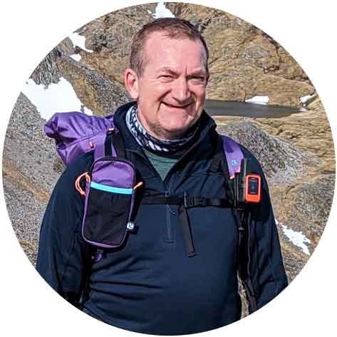
Danny Pearson |
||
|
Dan is a keen distance walker who loves to geek over the latest gear. In the last few years, Dan has completed a couple of TGO Challenge crossings of Scotland (with another planned for 2024), GR221 in Mallorca, Dales High Route and Hadrian’s Wall plus countless other self-planned routes. A keen mountain biker but finds he doesn’t bounce so well these days when the inevitable happens. |
||