Jump to: Our Verdict / Features / Specifications
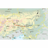
English-language guidebook to the Karnischer Höhenweg, a 170km waymarked hut-to-hut trek along the border between Italy and Austria. Also known as the Carnic Peace Trail, it runs west to east along the Ridge of the Carnic Alps, the site of the WW1 front line. With information on planning your trip, accommodation and the history of the area.
Cicerone says
This guidebook describes the Karnischer Höhenweg, a 170km long-distance walk through the beautiful Carnic Alps which straddle the border between Austria and Italy. Following a high Alpine trail along the main ridge, the route is clearly waymarked and requires a reasonable level of fitness, a sense of adventure and a head for heights, but no special equipment or technical expertise. It can be walked between mid-July and the end of September and takes up to a fortnight, though it is possible to devise shorter itineraries taking in the highlights.
The guide describes the full route of the Karnischer Höhenweg from Arnbach, near Sillian, to Arnoldstein, near Villach, and includes plenty of practical information to help you prepare for the walk. Each stage features comprehensive route description, clear mapping and fascinating insights into the history of the 'war in the mountains' plus other local points of interest. Accommodation listings and other useful contacts can be found in the appendices.
Also known as the Friedensweg ('Peace Trail'), the route follows the First World War front line, and reminders of the conflict are everywhere. But the trail isn't just rich in historical interest: this is Alpine ridge-walking at its best, boasting spectacular mountain vistas and views of the Dolomites, Hohe Tauern and Julian Alps. The guide covers two key variants of the trail, one on the Austrian side of the border, the other on the Italian side. Also included is an optional ascent of Monte Coglians, the highest peak in the Carnic Alps, and a visit to the open-air museum at the Plöckenpass.
Our Verdict
For nearly 50 years Cicerone have been producing guidebooks on recognised treks, regions, areas and general tips for hikers.
We have used them countless times and they've always provided excellent insight and knowledge that you only get through experience, giving you the edge to make your trip a success and more enjoyable too.
If you're a gram counter you can easily remove sections of the book to take with you making your own ultra-lightweight guidebook with only the essential sections that you require.
- Reviewed by Ultralight Outdoor Gear
Features
- Seasons: The Karnischer Höhenweg is a high Alpine trek and can only be walked in the summer between mid-July and the end of September
- Centres: A linear ridge walk, the Karnischer Höhenweg starts at Sillian in the west and ends near Arnoldstein in the east, and crosses major road passes at Plöckenpass and Nassfeld
- Difficulty: The Karnischer Höhenweg is a clearly waymarked and well-supported high-altitude trek. The key requirements for its enjoyment are a reasonable level of fitness, a sense of adventure and a head for heights. There are a few places where steel cables and ladders need to be negotiated but these don't require any special equipment or technical expertise
- Must See: First World War remains; the open-air museum at the Plöckenpass; views of the Dolomites, Hohe Tauern and Julian Alps; the unique geology of the Carnic Alps UNESCO geopark; Monte Coglians - the highest summit in the Carnic Alps and home to the Peace Bell
Specifications
- Edition: First
- Number of pages: 160
- Size: 17.2 x 11.6 x 1.0cm
- Weighs 200g
Contents
Introduction
The Peace Trail
The route
World War I earthworks and remains
The landscape and views
Geology
Plants and wildlife
How hard is the walk?
Selecting an itinerary
Getting to and from the route
When to go
Accommodation and food
Budget
What to take
Routefinding
Safety and emergencies
Using this guide
The route
Stage 1 Arnbach to Obstanserseehütte
Stage 2 Obstanserseehütte to Porzehütte
Stage 3 Porzehütte to Hochweißsteinhaus
Stage 4 Austrian route: Hochweißsteinhaus to Gasthof Valentinalm
Stage 4A Italian route: Hochweißsteinhaus to Rifugio Marinelli
Stage 5 Austrian route: Gasthof Valentinalm to Zollnerseehütte
Stage 5A Italian route: Rifugio Marinelli to Plöckenpass
Stage 5B Italian route: Plöckenpass to Casera Pramosio
Stage 5C Italian route: Casera Pramosio to Zollnerseehütte
Stage 6 Zollnerseehütte to Nassfeld
Stage 7 Nassfeld to Gasthaus Starhand
Stage 8 Gasthaus Starhand to Arnoldstein
Appendix A Route breakdown
Appendix B Accommodation
Appendix C Useful contacts


